Truly integrated
AERMOD, AERMET, AERMAP and BPIPPRM combined into one interface.
Loading…
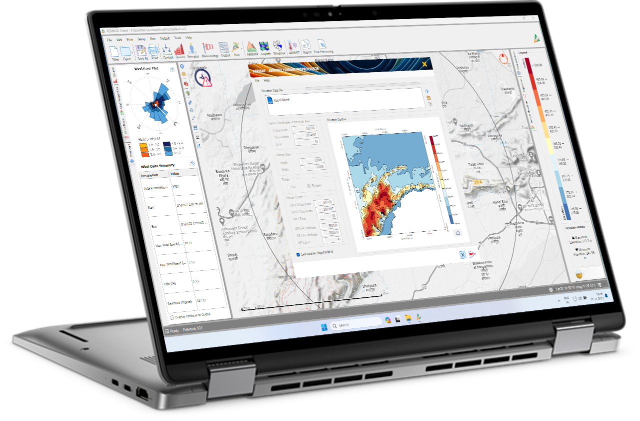
AERMOD Cloud® provides a unified interface to the U.S. EPA’s AERMOD Modelling System, combining AERMOD, AERMET, AERMAP and BPIPPRM into a single streamlined workflow. Built for Environmental Impact Assessment (EIA) and regulatory submissions — it simplifies setup, enforces compliance, and boosts productivity for professional air dispersion modelling.
Need help? Contact software support.
AERMOD, AERMET, AERMAP and BPIPPRM combined into one interface.
90 m DEM resolution for terrain processing via AERMAP.
Integrated AERMET with Excel-to-SAMSON conversion.
Run multiple pollutants in one project file.
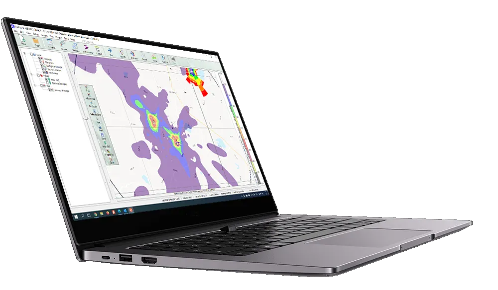
Automatic gridding, contouring and customizable isopleths with overlays.
Handles point, area, line, volume, open pit and polygonal emissions.
Integrated BPIPPRM for building downwash calculations.
Export isopleths as KML for 3D overlays and presentation.
Advanced analysis: contour plots, time series, percentiles, filtering and meteorological data viewer.
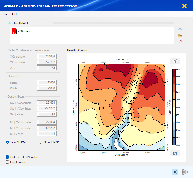
90 m elevation data support for AERMAP to evaluate complex terrain and hill-height scale.
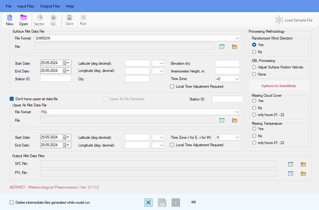
Integrated AERMET pipeline; includes Excel-to-SAMSON aids and met QA views.
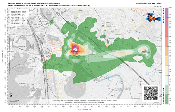
Automatic gridding, contouring, custom isopleths and overlays (basemap, receptors, wind rose).
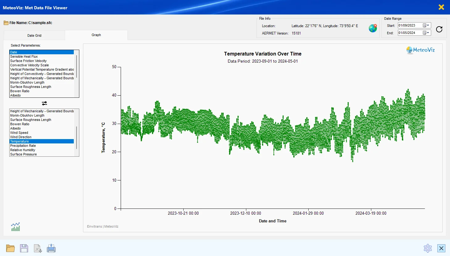
Visualise surface/profile data and generate charts to assess atmospheric conditions.
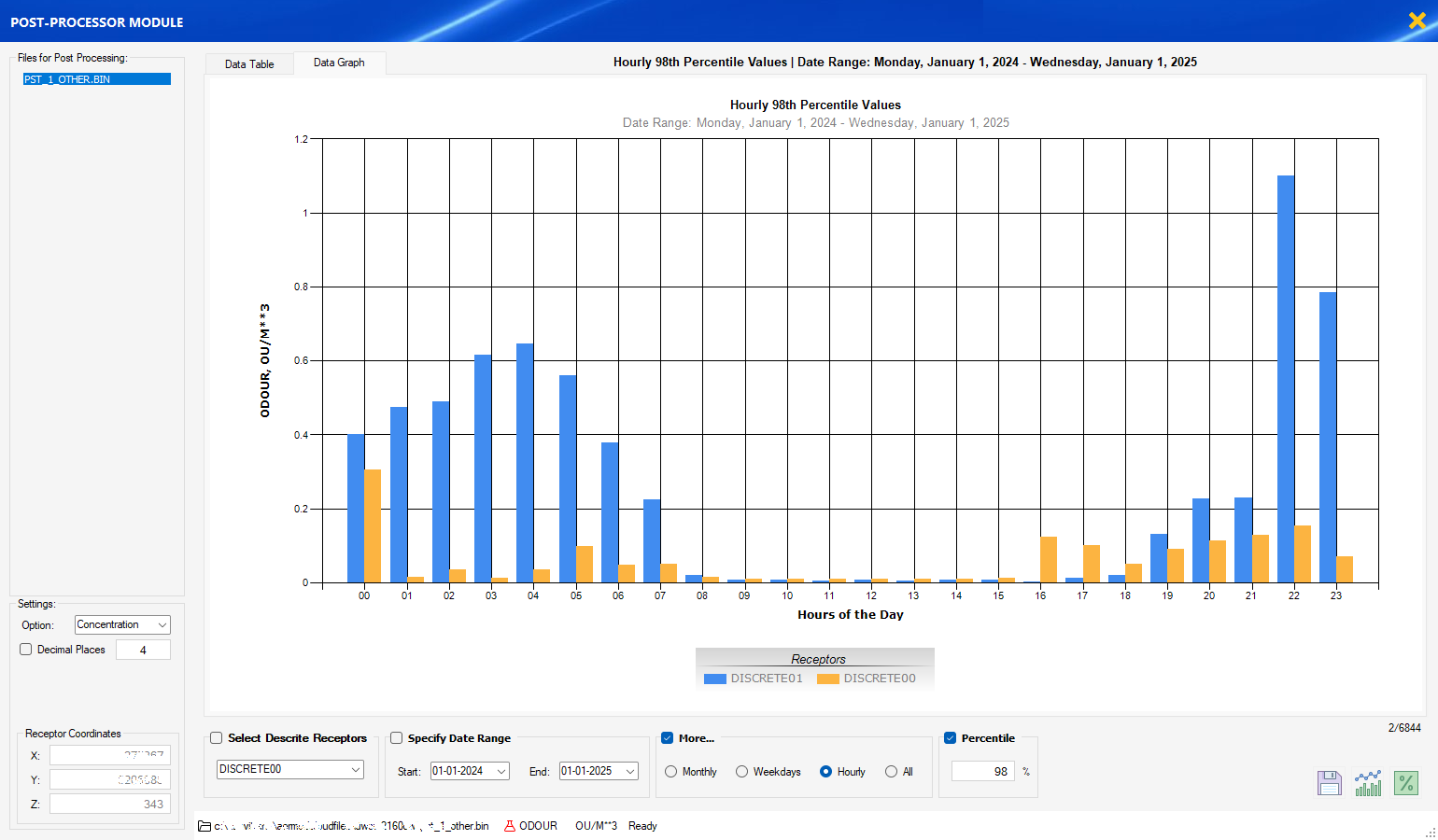
Time-series, percentile filters, multi-parameter slicing, and export to GIS/KML.
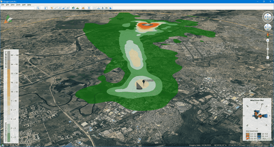
Export isopleths for Google Earth™ visualisation and client sharing.
GST notice: Prices exclude taxes. 18% GST applies at checkout for Indian customers.
Perpetual license: One-time payment — use the purchased version as long as compatible. Upgrades and support are available via annual maintenance (AMC).
Before you purchase:
If your organization requires internal approval or prefers bank transfer instead of online payment, you can request a formal quotation. Submit your details and our team will email you a customized Proforma Invoice along with our bank account information.
Updates are free for active subscribers and customers on maintenance. Use your account credentials to access downloads.
AERMOD is developed and maintained by the U.S. EPA / AERMIC and is public domain software. AERMOD Cloud® is a proprietary interface developed by Envitrans® that provides workflow automation, integration, and user support. Licensing applies to the Envitrans GUI and related tools only — the integrated environment, automation, and support features are Envitrans intellectual property.