A brief description of Weather Research and Forecasting (WRF) model and its application in air dispersion modelling. At Envitrans, the WRF model run focuses on generating high resolution meteorological data with the objective of gathering enough information to create AERMOD / AERMET / CALPUFF meteorological input files.
Weather Research and Forecasting Model
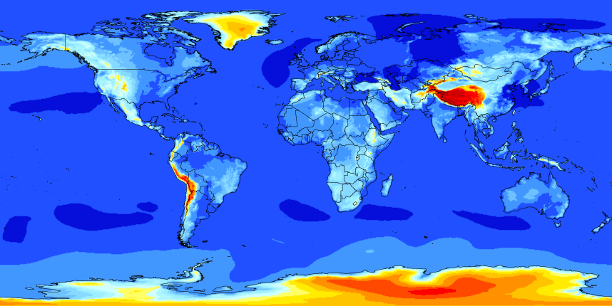
The Weather Research and Forecasting (WRF) Model is a next-generation mesoscale numerical weather prediction system designed for both atmospheric research and operational forecasting applications. The model serves a wide range of meteorological applications across scales from tens of meters to thousands of kilometres. WRF has a large worldwide community of registered users (a cumulative total of over 39,000 in over 160 countries).
The WRF model pulls in observations and archived meteorological model data from the region around the modelling site and uses the same physical equations that are used in weather forecasting to model the historical weather conditions at the specific project location.
The WRF can produce simulations based on actual atmospheric conditions (i.e., from observations and analyses) or idealized conditions. WRF offers operational forecasting a flexible and computationally-efficient platform, while reflecting recent advances in physics, numeric, and data assimilation contributed by developers from the expansive research community. WRF is currently in operational use at NCEP and other national meteorological centres as well as in real-time forecasting configurations at laboratories, universities, and private companies.
Input of Meteorological Data
WRF cannot directly use conventional meteorological data, instead, the model uses objective analysis of global weather reports. Objective analysis is a process of analysing the observed data and outputting them into a regular grid. The meteorological field is "balanced" to take account of the energy and momentum equations of the atmosphere. These objective analyses are products of global models, which are maintained by National Weather Centres or NCEP (National Centre for Environmental Protection).
The latest NCEP Global Reanalysis data is used for input to WRF. The NCEP reanalysis has a resolution of 0.25 degrees by 0.25 degrees for the entire globe. For further details on the Global Reanalysis data set, please refer to the NCAR data website at http://rda.ucar.edu/datasets/ds083.3/.
The grid dimensions and number of grid points that are commonly used at Envitrans for WRF runs when obtaining AERMOD meteorological formatted data files:
- External Source Data: NCEP GDAS on 0.25° by 0.25° grid (grib2 data)
- Grid Resolutions: 4 km
WRF to AERMOD and AERMET
The new U.S. EPA modelling guideline (Appendix W) officially took effect on May 21, 2017. One impactful change in the guideline is the approval to utilize prognostic meteorological data through the U.S. EPA's Mesoscale Model Interface Program (MMIF) pre-processor to generate inputs for regulatory modelling applications using AERMET and AERMOD. Section 8.4.2(a) of Appendix W states: "When processing prognostic meteorological data for AERMOD, the Mesoscale Model Interface Program (MMIF) should be used to process data for input to AERMET." This new option provides stakeholders with an alternative to using the standard NWS airport data in situations where nearby observational data is not available or where meteorological conditions change rapidly with distance.
To assist modelers with using WRF, MMIF and AERMET to process AERMOD-ready meteorological data, the U.S. EPA has published a MMIF guidance document on the use of prognostic meteorological data and the MMIF program. The Mesoscale Model Interface Program (MMIF) converts prognostic meteorological model output fields to the parameters and formats required for direct input into dispersion models. Supported dispersion models include AERMOD, SCICHEM, and CALPUFF.
Data referencing / Quality Check
Besides following the proper procedures of running WRF and MMIF, the final outputs passes through some basic QC/QA procedures which mainly follow the pattern analysis with respect to available records of historical meteorological data (Climatological Tables, IMD) of nearby stations. Therefore, the processed data is a representative dataset of the area suitable for modelling purpose.
Conclusion
The methodology currently in use adopts the U.S. EPA guidance and accepted models, such as MMIF and AERMET. We continue to conduct various analyses on our current approach in order to improve our results, and to provide guidance on conditions when better use of direct data from WRF or data processed through AERMET would be more appropriate.
Meanwhile, the current approach should already be acceptable "as is" as it is based on accepted methods and software codes.