AERMOD Met Data Services

Met Data Services

We provide AERMET and AERMOD Model-ready Meteorological and Terrain datasets for any specific location. The data is pre-processed appropriately to the standards of U.S. EPA.

Met Data - Same Day Delivery

Within 24-hour, we deliver model-ready files for any location inside INDIA for direct AERMOD or AERMET or CALPUFF model run.

Order Now
training on demand

Training On Demand

Envitrans develops and delivers on site and online training courses on air dispersion, tailored to the organization specific requirements.

Training Courses

Meteorological Data Services

Model-Ready Met Data

We provide Air Dispersion Model-ready Meteorological and Terrain datasets for any specific location. The data is pre-processed appropriately to the standards of U.S. EPA.

WRF Model-Ready Data

Envitrans offers modelled meteorological data for any specific coordinates using the Weather Research and Forecasting (WRF) mesoscale model. All WRF modelled data outputs are processed for direct input to the AERMOD, AERMET and CALPUFF air dispersion models.

AERMOD-ready WRF data is generated using the US EPA Mesoscale Model Interface Program (MMIF) and produces data files for direct input to the AERMOD air dispersion model. The MMIF converts WRF model output fields to the parameters and formats required for direct input into dispersion models.

AERMOD Ready

You will be provided with the following AERMOD model ready data files:

  • Surface Met Data File (*.SFC)
  • Profile Met Data File: (*.PFL)

AERMET Ready

We provide AERMET compatible files in the following format:

  • Surface Met Data File: ONSITE Format (*.DAT)
  • Upper Air Met Data File: FSL Format (*.FSL)
  • AERMET Input Files for Stages 1, 2, 3 (*.IN)

CALPUFF Ready

From WRF data, MMIF can produce four output files (TXT, DAT, GRD, and AUX). These files consists of three-dimensional data spanning many vertical layers and covering a horizontal grid and domain specified by the client.


AERMOD-Ready or AERMET-Ready Data?

We process and provide both AERMOD and AERMET-ready meteorological data. Now, the question is which one do you need for your project! Note that land use parameters can change from place to place and season to season, so purchasing AERMET-ready meteorological data will enable you to input the desired land use parameters during the meteorological data processing through AERMET.


Running AERMET Version 21112

To run AERMET version 21112, the user can combine Stage 1, 2, and 3 control files into one control file. However, to ensure that the AERMET run is executed successfully, the user should follow these specific steps:

  • Combine the existing Stage 1, 2, and 3 control files into one control file.
  • Ensure that all years associated with XDATES are in 4-digit format.
  • Remove the Stage 2 and Stage 3 JOB pathway and keywords within the combined file.
Terrain Data

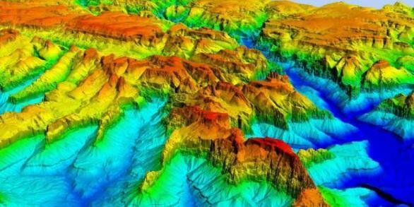
Terrain Elevation Data

Terrain data are often a necessary part of air dispersion modelling. AERMAP, which is a terrain pre-processor for AERMOD; processes Digital Elevation Data and creates a file suitable for use within an AERMOD control file. This file contains elevation and hill-height scaling factors for each receptor in the air dispersion study.

We can provide Terrain Data in Digital Elevation Model (DEM) and National Elevation Dataset (NED) GeoTIFF formats. You can buy DEM tiles for most of the world. Each tile covers a block of land that is 1 degree of latitude by 1 degree of longitude (approximately 100×100 km), with a resolution of approximately 90 meters. We may also provide custom sized DEM tiles on demand.

Contact Us
AERMOD Cloud

AERMOD Cloud®

A truly integrated US EPA AERMOD air dispersion modelling system - AERMET, AERMAP and BPIPRM within ONE Interface.

Explore Features
X
Do you need any help?

Please wait...